All pictures Copyright E & BJ Capper Nagold 2004-20
7. Ring of Kerry
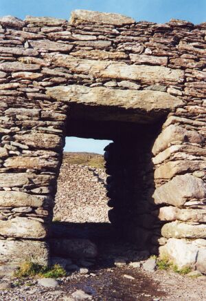
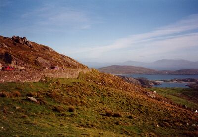
Stein-Fort
Stone Forts
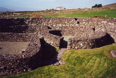
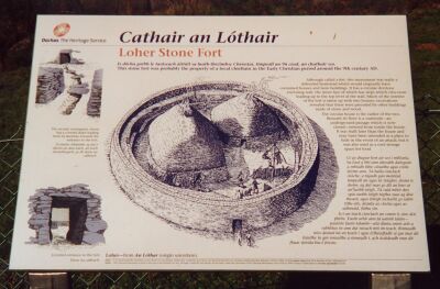
Dieses Loher Stein-Fort war im Besitz eines lokalen Herrschers im 9.Jahrhundert nach Christi. Es war jedoch weniger eine Verteidigungsanlage als ein Bauernhof. Steintreppen führen in Zick-Zack-Linien die Außenmauern hinauf und hinab.
The Loher Stone Fort belonged to a local ruler in the 9th century AD. It was more a farm than a fortification. Stone steps led in a zigzag up and down the external walls.
Unter dem runden Gebäude gab es einen Keller. Er war sowohl zum Kühlen von Nahrungsmitteln als auch zum Schutz bei Überfällen gedacht.
Under the round building was a cellar. It was there both as a cool-room for food and also as a refuge in case of attack.
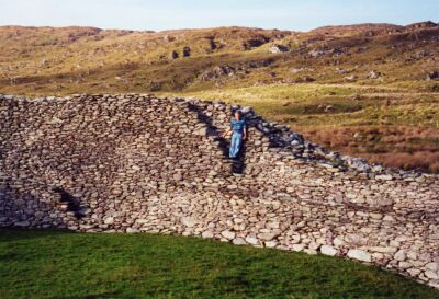
Staigue Fort - ein weiteres Stein-Fort mit gewaltigen Ausmaßen. Geschütz liegt es in einem Talschluss. Obwohl einige Kilometer im Land gelegen, öffnet sich nach vorne der Blick auf Küste, Inseln und Meer. John missachtet ein Verbotsschild und besteigt die Ringtreppen. Hier das Fahndungsfoto.
Staigue Fort is a another massively large stone fort. It is tucked away at the head of a valley. Although it is some distance inland, there is a good view from the front away to the coast, islands and sea. I am not really ignoring the no-climbing signs, just offering myself to give an idea of the large scale!
Wer hat nur all die Steine geschleppt? Maximale Wandstärke: 4 Meter!
Who did the work of carrying all these stones? The walls are up to 4m thick!
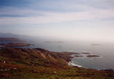
Wir befinden uns jetzt am südlichen Rand des "Ring of Kerry" und sind bezaubert von den wie wahllos über das Meer verschütteten Inseln.
We have now reached the southern part of the Ring of Kerry and are captivated by the islands scattered randomly in the sea.